Video Slideshow
We spent December 2016 in Central America with eight other family members on OAT's Route of the Maya tour travelling to El Salvador to Honduras to Guatemala to Belize. We learned about the Maya creation legends and visited the sites that expressed the origins of those stories.
San Salvador
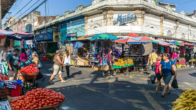
In San Salvador we visited Boqueron Park, which is situated atop one of the peaks of San Salvador Volcano. We had a good view into the caldera and surrounding areas.
We began with a trip to Boqueron Park, which is situated atop one of the peaks of San Salvador Volcano. From this landscaped park, we had fantastic views of the volcano's craters, as well as the surrounding city.
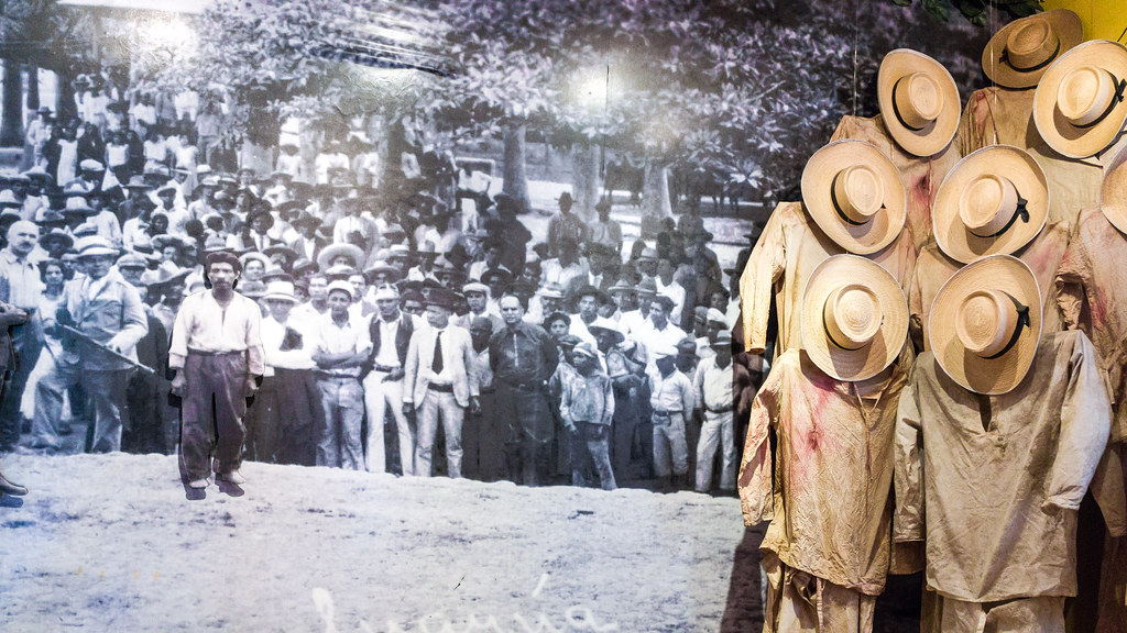
Then, we visited the Museo de la Palabra y la Imagen, which collects items such as photos, videos, publications, and drawings to preserve the culture and history of El Salvador. The museum's exhibits focus on human rights during armed conflicts and offer diverse perspectives on El Salvador's tumultuous military history, as well as how it has affected its people.
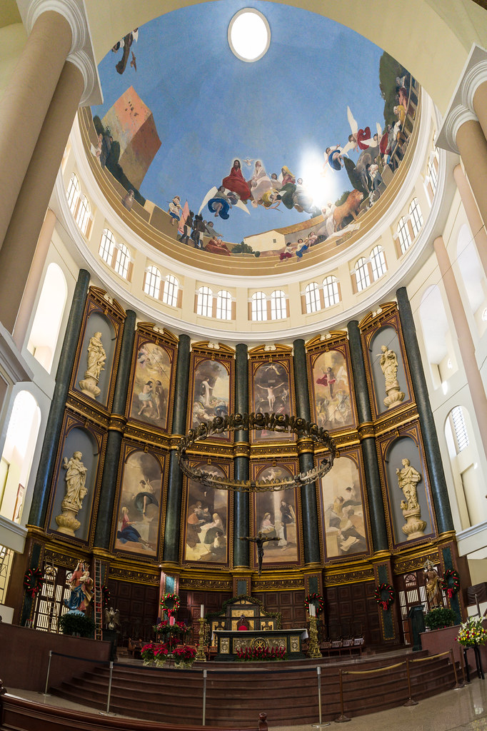
We visited San Salvador Cathedral in the center of the city and the burial site of Oscar Romero, a prominent Roman Catholic priest and archbishop of El Salvador in the 1960s and 70s. Speaking out against human rights violations and begging the military to stop killing civilians, Romero often clashed with the local government and the Catholic Church. In 1980, he was shot while celebrating Mass, presumably during an organized attack by a Salvadoran death squad.
Joya de Ceren
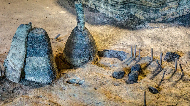
Joya de Ceren was discovered by accident in 1976 by a bulldozer driver leveling ground for a government agricultural project.
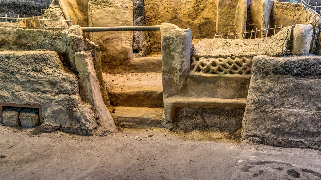
Joya de Ceren, a UNESCO World Heritage Site, and a Maya archaeological site. It is aptly nicknamed the "Pompeii of the Americas," because like Pompeii it features remarkably intact dwellings that were preserved for centuries after being buried by volcanic ash. Dating from about AD 600, the ruins here were the homes, communal baths, and public buildings of ordinary people, not as at most other sites, the monumental temples of royalty. This site was discovered in 1976 and is still being excavated. Evidence suggests that the inhabitants were able to evacuate as the eruption destroyed their village, but they left utensils and textiles behind that provide revealing glimpses of Maya life more than a millennium ago.
Copan

Copan, Honduras, was the capital city of a major Classic period Maya kingdom from the 5th to 9th centuries AD.
In AD 250, the Maya Mesoamerica's (and the Western Hemisphere's) most advanced culture began constructing elaborate cities that flourished until about AD 900, an era now known as the Classic Period of Maya civilization. Xukpi (to the Maya), now known as the ruins of Copan was designated a UNESCO World Heritage Site in 1980. It Copan is Honduras' most significant pre-Columbian site and the most elaborate of all Maya cities, earning it the title "Athens of the Maya World."
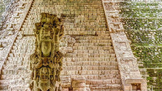
The most impressive remnant is the Hieroglyphic Stairway 63 steps with 2,500 glyphs, or symbols, carved into the stone, transforming the pyramid's steps into the Maya's longest historical record. The ancient Maya belief system gave extraordinary importance to precisely measuring and recording the dates of events, such as the reigns of rulers, and many of Copan's monuments and those of other Maya centers are elaborate sacred calendars.
Antigua Guatemala
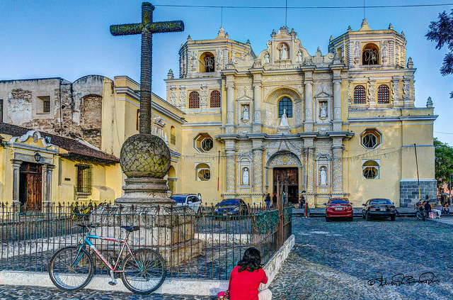
Antigua Guatemala is famous for its well-preserved Spanish Baroque-influenced architecture as well as a number of ruins of colonial churches. It sits just to the north and east of three volcanos that dominate the skyline.
Founded in 1543, "La Antigua" served as the seat of Spain's colonial government whose influence extended beyond Guatemala to Chiapas (in southern Mexico), Belize, Honduras, Nicaragua, and parts of Costa Rica until the Spanish Crown ordered its relocation to the site of what is now Guatemala City in 1776.
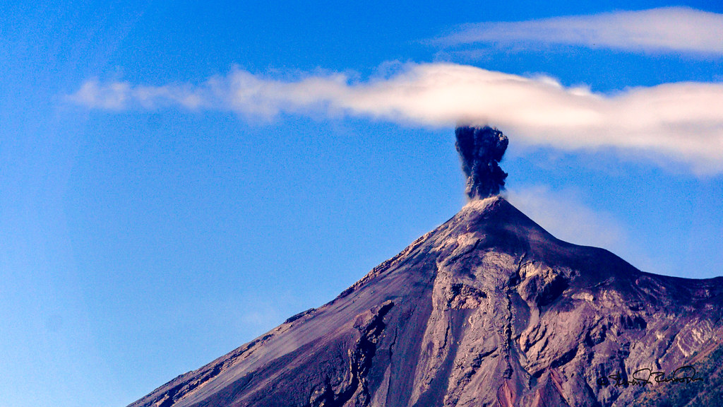
We visited Cerro de la Cruz, or Hill of the Cross, located just north of the city. The hill offers sweeping views of Antigua with the towering Volcan de Agua in the background, and Volcan Fuego erupting for us on cue.
Panajachel
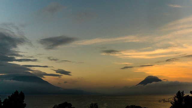
Panajachel is situated on the northeast shore of Lake Atitlan which might be considered the cradle of Maya theology.
While Panajachel was once a quiet Maya village, it has blossomed into a bustling town, drawing visitors with its volcanic vistas and proximity to Lake Atitlan. The lake is encircled by three towering volcanoes San Pedro, Toliman, and Atitlan which are reflected in its azure waters, it's been called "the closest thing to Eden on Earth." And with a depth of more than 1,000 feet, it's also the deepest lake in Central America, formed by a powerful volcanic explosion more than 85,000 years ago.
Indigenous Maya people settled on Atitlan's shores around the beginning of the last millennium, making this the heart of the Maya world. Their ancient traditions, beliefs, and crafts are preserved in the many Maya textiles, with their distinctive geometric patterns, that are still created here using traditional methods.
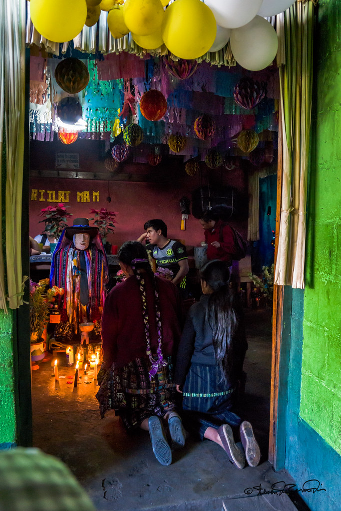
Maximon a famous Maya deity has an altar where local people still perform rituals to honor him. the village of San Antonio Palopo, a small settlement lined with adobe homes the residents of which still wear traditional Maya clothes. We visited a cooperative where women spin, dye and weave fabrics using traditional methods.
Guatemala City
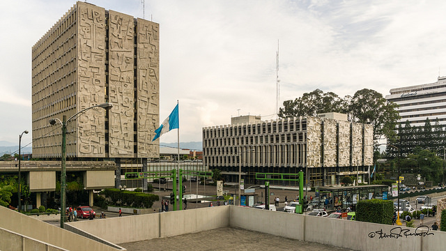
Guatemala City is the capital and largest city of Guatemala, and the most populous in Central America.

We visited the Safe Passage School in one of Guatemala City's poorest neighborhoods. In this area surrounding the city's garbage dump, countless families are forced to make a living by picking through endless piles of trash, looking for anything of value they can resell. Due to extreme poverty, many of the area's adults and children are illiterate.
The Safe Passage School is run by a local nonprofit organization that is trying to change this by working with children and young adults between the ages of 2 and 21. The more than 550 children enrolled in this program which is supported in part by Grand Circle Foundation can attend this full-day school through the second grade. Then, they receive financial assistance to cover the cost of public school enrollment, school supplies, and uniforms, as well as hot meals, homework help, medical care, and sports and art programming. The nonprofit also assists these children's parents and families by providing them with access to adult literacy and social entrepreneurship programs.
Tikal
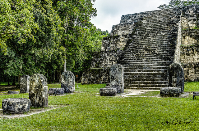
Tikal is one of the largest archaeological sites and urban centers of pre-Columbian Maya civilization.
It was the capital of a conquest state that became one of the most powerful kingdoms of the ancient Maya. Tikal is the best understood of any of the large lowland Maya cities, with a long dynastic ruler list.
We explored the Maya city of Tikal, a magnificent 1,800-yearold complex and UNESCO World Heritage Site. At its peak, Tikal was home to an estimated 100,000 Maya, and it was one of the most important urban centers of its time. Immersed in the Petan jungle in Tikal National Park, the grounds are expansive and inspiring, and it's difficult to determine which is more impressive the accomplishments of man or those of nature.
The Tikal site comprises roughly six square miles and contains about 3,000 structures including temples, pyramids, tombs, palaces, ball courts, and terraces the tallest of which rise above the leafy canopy and vie for your attention with the assortment of animals and exotic birds. Within the park, it's possible to spot a great variety of wildlife.
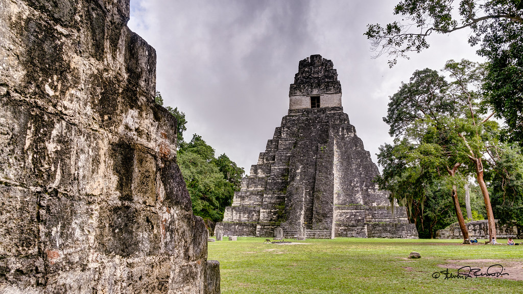
Tikal's Great Plaza has an 144-foothigh Temple of the Grand Jaguar, the tomb and memorial of Maya ruler Moon Double Comb, who was buried with many treasures, including 180 pieces of elaborately carved jade.
Lamanai
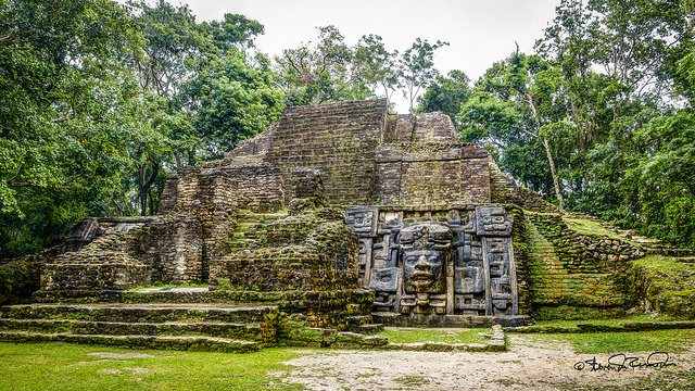
Lamanai was once a major city of the Maya civilization, located in the north of Belize.
It is famous for its exceptionally long occupation spanning three millennia. Lamanai was not abandoned at the end of the 10th century AD. as were many other Maya cities.
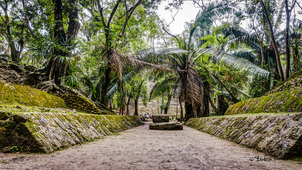
We visited the ruins of Lamanai (a Maya word meaning "submerged crocodile"), named for the abundance of crocodiles that make the adjacent New River Lagoon their home. Nestled amid thick jungle vegetation alive with exotic birds and howler monkeys, Lamanai is accessible only by boat, and boasts the second-largest pre- Classic structure in the Maya world: its magnificent High Temple. The site also features the 13-foot Mask Temple, a stone temple mask of a Maya king. The Maya lived at Lamanai for more than 3,000 years, and the ruins here are some of the oldest in Belize, dating to 700 BC. Excavation of the site began in the 1970s, and thus far less than five percent of the structures here have been unearthed. Excavation of the ruins continues to this day.
